The Importance of Consultation
Meaningful consultation with the public and Indigenous communities is critical to assessing environmental impacts. The consultation process began in 2007, and feedback, such as changes to the proposed route, interchanges, and water crossings, has already been incorporated into the Preliminary Design.
The Ontario Ministry of Transportation (MTO) is committed to giving people the information and opportunity to have their say about the Highway 413 Project. The assessment of environmental impacts includes a comprehensive consultation program that continues to engage many different groups and considers different points of view.


Previous Consultations
We are committed to providing an archive of historic information on Highway 413. As such, some documents produced in the past may not meet current accessibility standards. If you have any questions, please contact the project team, project_team@highway413.ca.
Public Information Centre
Public Information Centre #4 - Preliminary Design and Assessment of Environmental Impacts Update
September 2023
A round of Public Information Centres (PIC) was held on September 28, 2023 (York Region), October 3, 2023 (Halton Region) and October 5, 2023 (Peel Region) to provide an update on the Highway 413 project and the process for assessment of environmental impacts. The PIC focused on sharing information on the Preliminary Design, underway studies, answering questions, and obtaining input. The PIC was conducted as an online session hosted through the Zoom platform.
Download materials from the September and October 2023 PICs:
Presentations
Preliminary Design and Environmental Assessment Update - Public Information Centre #4


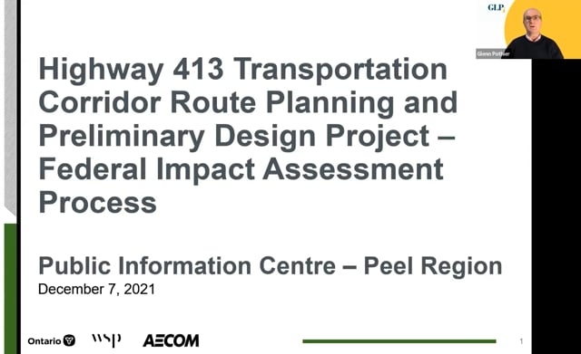
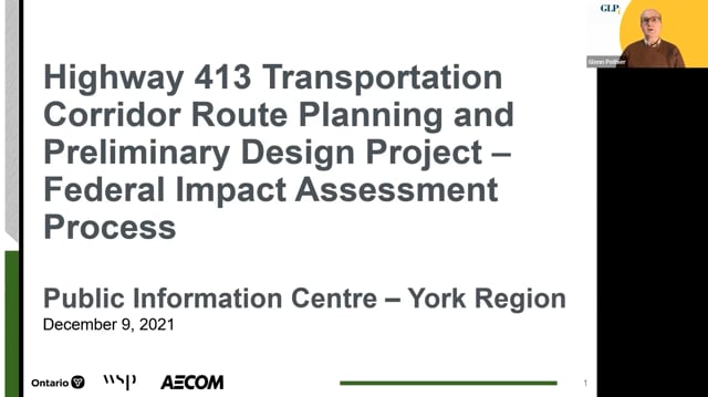
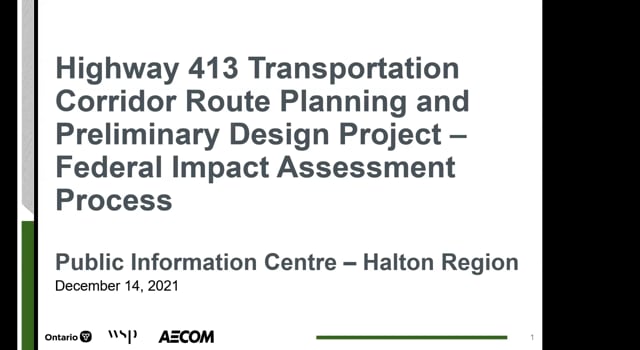
Public Information Centre #3 - Focused on the Federal Impact Assessment Process
December 2021
On May 3, 2021, the Federal Minister of Environment and Climate Change designated the Highway 413 Project under the Federal Impact Assessment (IA) Act. MTO is preparing an Initial Project Description (IPD), which the Impact Assessment Agency of Canada (IAAC) will use to inform their decision on whether a Federal IA of the project is required.
A round of Public Information Centres (PIC) was held on December 7, 2021 (Peel Region), December 9, 2021 (York Region) and December 14, 2021 (Halton Region) to help shape the content of the IPD and to ensure that community interests are captured appropriately in the IPD prior to submission to IAAC. The PIC focused on sharing the reason for the Federal designation, reviewing the IA process, discussing the technical studies being added to the project in response to the Federal designation, obtaining feedback on the Project Team’s understanding of the socio-economic contexts of communities and the key issues raised by stakeholders and Indigenous communities. The PIC was conducted as an online session hosted through the Zoom platform.
Presentations
Federal Impact Assessment Process - Public Informations Centres
Public Information Centre #2
September / October 2019
The second round of Public Information Centres (PIC #2) was held on September 19, September 26 and October 3, 2019, in Woodbridge, Georgetown and Caledon respectively. PIC #2 was an informal drop-in centre with Project Team representatives available to answer questions.
The purpose of PIC #2 was to present:
- Updates since study resumption
- Study background and process
- Draft Technically Preferred Route and the evaluation
- Draft Preferred interchange locations
- Draft 2019 Focused Analysis Area
- Community Value Plan process.
Download materials from Public Information Centre #2
- Public Information Centre #2 Comment Sheet (PDF 40 KB )
- Welcome Area (PDF 1,119 KB)
- Contextualization (PDF 332 KB)
- Study Background and Process (PDF 2,587 KB)
- Indigenous Communities (PDF 136 KB)
Community Value Plan
- Community Value Plan Overview (PDF 372 KB)
- Community Value Plan Comment Sheet (PDF 60 KB)
- Community Value Plan Group Application (PDF 56 KB)
Permission to Enter
- Permission to Enter Overview (PDF 163 KB)
- Permission to Enter Fact Sheet (PDF 882 KB)
Summary Report
- Public Information Centre #2 Summary Report (PDF 9 MB)
Evaluation of the Short Listed Route and Interchange Location Alternatives
- Evaluation Overview (PDF 4,948 KB)
- West Section of the Study Area (PDF 7,076 KB)
- Central Section of the Study Area (PDF 6,889 KB)
- East Section of the Study Area (PDF 5,877 KB)
- Short Listed Route Alternatives By Section – Aerial Photography Background (PDF 8,353 KB)
- Technically Preferred Route By Section – Aerial Photography Background (PDF 6,508 KB)
- Technically Preferred Route Roll Plan – Aerial Photography Background (PDF 1,730 KB)
- Technically Preferred Route Roll Plan – Agricultural Background (PDF 17,818 KB)
- Technically Preferred Route Roll Plan – Existing Land Use Background (PDF 10,295 KB)
- Technically Preferred Route Roll Plan – Future Land Use Background (PDF 6,594 KB)
- Technically Preferred Route Roll Plan – Natural Environment Background (PDF 3,411 KB)
- Preferred Interchange Locations (PDF 4,769 KB)
- 2019 Focused Analysis Area (PDF 13,697 KB)>
- Short List of Route Alternatives - Comparative Evaluation of Net Effects and Rankings (PDF 5 MB)
Community Advisory Group (CAG) and Greenbelt Transportation Advisory Group (GTAG)
- CAG and GTAG Overview (PDF 231 KB)
- Community Advisory Group Application (PDF 78 KB)
- Greenbelt Transportation Advisory Group Application (PDF 78 KB)
Public Information Centre #1
November/December 2014
The first round of Public Information Centres was held on November 27, 2014 (Georgetown, Ontario) December 2, 2014 (Woodbridge, Ontario) and December 4, 2014 (Caledon, Ontario). Public Information Centre #1 was an informal drop-in centre with ministry and consultant team representatives available to answer questions.
The purpose of Public Information Centre #1 was to present:
- Study background and process
- Existing conditions within the study area
- Development and screening of the long list of route alternatives
- Identification of the short list of route alternatives and potential interchange locations
- The Focused Analysis Area
- Factors and criteria for evaluating the short list of route alternatives
Download materials from Public Information Centre #1:
- Notice of Public Information Centre #1 (PDF 402 KB)
- Section 01 – Welcome and Overview (PDF 9 MB)
- Section 02 – Alternatives (PDF 10 MB)
- Section 03 – Background and Process (PDF 3 MB)
- Section 04 – Existing Conditions Maps
- Map 4-1 – Land Use Existing Conditions (PDF 18 MB)
- Map 4-2 – Land Use General Future (PDF 2 MB)
- Map 4-3 – Natural Environment Existing Conditions (PDF 10 MB)
- Map 4-4 – Agricultural Existing Conditions (PDF 9 MB)
- Section 05 – Consultation (PDF 2 MB)
- Section 06 – First Nations (PDF 295 KB)
- Comment Sheet for PIC #1 (PDF 200 KB)
- Draft Screening of the Long List of Route Alternatives (PDF 2 MB)
- Public Information Centre #1 Summary Report (PDF 6 MB)
Community Engagement Webinar
Community Engagement Webinar #2
September 2021
To provide an update on the project and to address community questions, the Highway 413 Project Team hosted a Community Engagement Webinar (CEW) in July 2021. A second Community Engagement Webinar was held on September 29, 2021, via the Zoom platform. The same overview of the project as was presented in July was provided, followed by a question & answer period. Expert panelists from a variety of disciplines were in attendance to answer questions.
Community Engagement Webinar #1
July 2021
Community Engagement Webinar (CEW) #1 was held on July 28, 2021, via the Zoom platform. To further meet the public’s needs and address community questions, the Highway 413 Project Team hosted a CEW where the public and stakeholders were provided with the opportunity to understand more about the project and have their questions answered. The Highway 413 Project Team provided a brief overview of the project followed by a question & answer period. Expert panelists from a variety of disciplines were in attendance to answer questions.
Community Value Planning Meeting
Community Value Planning Meeting #3
May 2021
Community Value Plan (CVP) Meeting #3 was held on May 20, 2021, via the Zoom platform. Current CVP Team Members were invited to attend and an open invitation for new members was posted on the project website in early May 2021.
At CVP meeting #2 on November 3, 2020, CVP Team members recommended design elements that reflected the social, cultural, historical and environmental interests of their communities. The Highway 413 Project Team subsequently worked to incorporate these ideas into the preliminary design of the highway and transitway. At CVP Meeting #3 on May 20, 2021, CVP Team members provided comments on the draft CVP including roll plans and design elements that illustrate the application of the CVP Toolkit along the highway and transitway.
Download materials from Community Value Plan Meeting #3:
- CVP Meeting #3 Presentation (5 MB)
- CVP Meeting #3 Summary Report (22 MB)
- Draft Straw Model Design – Section 1 (3 MB)
- Draft Straw Model Design – Section 2 (1 MB)
- Draft Straw Model Design – Section 3 (3 MB)
- Draft Straw Model Design – Section 4 (4 MB)
- Draft Straw Model Design – Section 5 (4 MB)
- Draft Straw Model Design – Section 6 (4 MB)
- Draft Straw Model Design – Section 7 (4 MB)
- Draft Straw Model Design – Section 8 (4 MB)
- Draft Straw Model Design – Section 9 (3 MB)
Community Value Planning Meeting #2
November 2020
Community Value Plan (CVP) Meeting #2 was held on November 3, 2020, via the Zoom platform. Members of the public were invited to apply to be a member of the CVP Team at Public Information Centre #2 in 2019 and an open invitation was posted on the project website in Fall 2020.
A Community Value Plan (CVP) is being developed to incorporate public input into the design of the new multimodal transportation corridor. Members of our CVP Team will recommend design elements that reflect the social, cultural, historical, and environmental interests of their communities (covering such things as heritage commemoration, aesthetics, landscaping, trails, connectivity, wildlife crossings, artistic elements at the gateways, etc.). The CVP is focused on how best to implement the proposed new highway and transitway in the most context-sensitive manner, given the identified Preferred Route. It is not about where these facilities should be located or whether they should be built.
Download materials from Community Value Plan Meeting #2:
- CVP Meeting #2 Presentation (PDF 4 MB)
- CVP Meeting # 2 Summary Report (PDF 7 MB)
Additional Consultation
Focused Analysis Area
The 2025 Focused Analysis Area (FAA) prioritized refinements based on stakeholder input, environmental data, and design advancements as details on potential impacts become more evident. These modifications reflect the latest designs and environmental studies, with areas of higher design certainty or minimal environmental impact excluded. Changes from the 2020 FAA are outlined in white.
Final Evaluation of the Short List of Route Alternatives
Based on new information received after Public Information Centre #2 (PIC #2), the Project Team developed additional route alternatives and undertook supplementary analysis on the routes and crossing of the Humber River in Section 8. Given the interdependencies, changes in Section 7 were also included in the supplementary analysis.
A final evaluation of net effects for each route alternative was undertaken for all nine sections of the proposed highway.
The comparative evaluation table for each section is available below.
Confirmation of the Preferred Alignment
The Preferred Alignment (previously referred to as “Preferred Route”) was announced in August 2020. It was developed based on feedback received from PIC #2 on the Technically Preferred Alignment (previously referred to as “Technically Preferred Route”) in 2019. The Preferred Alignment map illustrates the route and interchange locations for the Highway 413 transportation corridor that will be developed to a preliminary design level of detail.
Workshops
Community Workshop #2
June 2015
The second round of Community Workshops was held on June 18, 2015 (Woodbridge, Ontario), June 22, 2015 (Georgetown, Ontario) and June 25, 2015 (Caledon, Ontario). The focus of this workshop was to update the community on work completed since Public Information Centre #1 including refinements to route alternatives, interchange locations, and the Focused Analysis Area. The project team sought input from the community on: issues and trade-offs associated with the route alternatives and potential interchange locations, and the route selection evaluation approach.
Download materials from Community Workshop #2:
- Community Workshop 2 Comment Sheet (PDF 66 KB)
- Presentation 1 – Overview of Study and Recent Works Completed (PDF 3 MB)
- Presentation 2 – Approach for Evaluating the Short List of Route Alternatives (PDF 839 KB)
- Presentation 3 – Trade Offs in the West Section of the Study Area (PDF 975 KB)
- Presentation 4 – Trade Offs in the Central Section of the Study Area (PDF 1 MB)
- Presentation 5 – Trade Offs in the East Section of the Study Area (PDF 850 KB)
- Refined Short Listed Route and Interchange Location Alternatives (PDF 9 MB)
- Section maps for Refined Short List of Route Alternatives and Potential Interchange Locations – May 2015 (PDF 10 MB)
- Summary of Evaluation Factors and Criteria & Examples of Trade Offs in the Study Area (PDF 146 KB)
- Summary of Evaluation Factors and Criteria for Alternative Methods (PDF 499 KB)
Community Workshop #2 Summary Report
- Community Workshop #2 Summary Report - Main Report (PDF 1 MB)
- Community Workshop #2 Summary Report - Appendix A (PDF 452 KB)
- Community Workshop #2 Summary Report - Appendix B (PDF 18 MB)
- Community Workshop #2 Summary Report - Appendix C (PDF 725 KB)
- Community Workshop #2 Summary Report - Appendix D (PDF 104 KB)
- Community Workshop #2 Summary Report - Appendix E (PDF 484 KB)
- Community Workshop #2 Summary Report - Appendix F (PDF 565 KB)
Introductory Community Workshops
July/August 2014
The Introductory Community Consultation Workshops were held on the evenings of July 24, 2014 (Woodbridge, Ontario), July 29, 2014 (Mississauga, Ontario), August 13, 2014 (Brampton, Ontario), and August 14, 2014 (Caledon, Ontario). Each workshop event presented identical information and provided the same opportunities to provide input to the Project Team.
The focus of this first round of workshops was to:
- Provide an overview of the study objectives, process and timelines
- Provide an opportunity for attendees to apply for participation in the Community Advisory Group and the Greenbelt Transportation Advisory Group
- Participate in interactive activities, including providing input on key issues and existing features within the study area to be considered in the development of the route and interchange alternatives, as well as providing input on the route location
Download materials from Introductory Community Workshops:
- Introductory Community Workshops Presentation (PDF 891 KB)
- Study Area Map from Introductory Community Workshop - Part 1 (PDF 16 MB)
- Study Area Map from Introductory Community Workshop - Part 2 (PDF 16 MB)
- Station 1 - CAG and GTAG displays (PDF 1 MB)
- Station 2 - Criteria and Methodology displays (PDF 549 KB)
- Station 3 - Existing Features displays (PDF 102 KB)
- Introductory Community Workshop Summary Report - Main Report (PDF 1 MB)
- Introductory Community Workshop Summary Report - Appendix A (PDF 533 KB)
- Introductory Community Workshop Summary Report - Appendix B (PDF 1 MB)
- Introductory Community Workshop Summary Report - Appendix C (PDF 2 MB)
- Introductory Community Workshop Summary Report - Appendix D (PDF 8 MB)
- Introductory Community Workshop Summary Report - Appendix E (PDF 607 KB)
Groups
Community Advisory Group
The Community Advisory Group (CAG) comprises representation from various interest groups, organizations, and individuals within and around the Highway 413 Route. The CAG enables direct communication between the community and the Project Team, consisting of MTO and their consultants. Members are asked to:
- Provide comments and suggestions on study findings
- Provide insight and discussion on potential issues, challenges, and opportunities
- Participate in developing strategies to address the issues and opportunities.
At the first Community Workshop and at Public Information Centre #1 (PIC#1), information on the CAG was provided and stakeholders interested in joining were encouraged to apply for membership.
Download Community Advisory Group (CAG) Documents:
- CAG Presentation – October 28, 2014 (PDF 1 MB)
- CAG Meeting Minutes – October 28, 2014 (PDF 203 KB)
- CAG Presentation – May 7, 2015 (PDF 5 MB)
- CAG Meeting Minutes – May 7, 2015 (PDF 526 KB)
- CAG Presentation – November 14, 2019 (PDF 11 MB)
- CAG Meeting Minutes – November 14, 2019 (PDF 86 KB)
Greenbelt Transportation Advisory Group
The Greenbelt Transportation Advisory Group includes representation from environmental interest groups, environmental ministries, and other Greenbelt experts. Greenbelt Transportation Advisory Group members are asked to share information regarding key environmental and agricultural features, discuss potential impacts to sensitive features within the Greenbelt, and discuss and generate mitigation strategies to be used. At the first Community Workshop and at Public Information Centre #1, information on the Greenbelt Transportation Advisory Group was provided and stakeholders interested in joining the Greenbelt Transportation Advisory Group were encouraged to apply for membership.
Download Greenbelt Transportation Advisory Group (GTAG) Documents:
- GTAG Presentation – October 29, 2014 (PDF 14 MB)
- GTAG Meeting Minutes – October 29, 2014 (PDF 195 KB)
- GTAG Presentation – May 7, 2015 (PDF 5 MB)
- GTAG Meeting Minutes – May 7, 2015 (PDF 197 KB)
- GTAG Presentation – November 14, 2019 (PDF 11 MB)
- GTAG Meeting Minutes – November 14, 2019 (PDF 87 KB)
Municipal Advisory Group
The Municipal Advisory Group includes representation at a staff level from the Regional Municipalities of Halton, Peel, and York as well as lower tier municipalities. The Municipal Advisory Group is a forum for the discussion of local planning and technical issues.
Download Municipal Advisory Group (MAG) Documents:
- MAG-RAAG Presentation – June 16, 2014 (PDF 3 MB)
- MAG-RAAG Meeting Minutes – June 16, 2014 (PDF 497 KB)
- MAG Presentation – November 7, 2014 (PDF 1 MB)
- MAG Meeting Minutes – November 7, 2014 (PDF 190 KB)
- MAG and RAAG Presentations – May 11, 2015 (PDF 4 MB)
- MAG and RAAG Meeting Minutes – May 11, 2015 (PDF 187 KB)
- MAG and RAAG Presentation – November 13, 2019 (PDF 11 MB)
- MAG and RAAG Meeting Minutes – November 13, 2019 (PDF 90 KB)
Municipal Executive Advisory Group
The Municipal Executive Advisory Group is a stakeholder advisory group formed to develop the Preliminary Design. It is a forum for discussing broad, strategic, and inter-regional transportation issues. Members include senior staff from the Regional Municipalities of Halton, Peel, York, and Metrolinx.
Download Municipal Executive Advisory Group (MEAG) Document:
- MEAG Presentation – September 24, 2014 (PDF 2 MB)
- MEAG Presentation – October 9, 2019 (PDF 11 MB)
Regulatory Agency Advisory Group
The Regulatory Agency Advisory Group includes potentially affected provincial ministries, agencies and federal departments. The Regulatory Agency Advisory Group is a forum for the discussion of local planning and technical issues.
Download Regulatory Agency Advisory Group (RAAG) Documents:
- MAG-RAAG Presentation – June 16, 2014 (PDF 3 MB)
- MAG-RAAG Meeting Minutes – June 16, 2014 (PDF 497 KB)
- RAAG Presentation – November 7, 2014 (PDF 1 MB)
- RAAG Meeting Minutes – November 7, 2014 (PDF 170 KB)
- MAG and RAAG Presentations – May 11, 2015 (PDF 4 MB)
- MAG and RAAG Meeting Minutes – May 11, 2015 (PDF 187 KB)
- MAG and RAAG Presentation – November 13, 2019 (PDF 11 MB)
- MAG and RAAG Meeting Minutes – November 13, 2019 (PDF 90 KB)